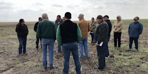
Playas Help Texans Live Within Water Means Photo by Jim Steiert

Playas Help Texans Live Within Water Means

A cutting edge producer of organic crops and livestock who sees playas as vital recharge wetlands shared his thoughts on what must be done to protect playas and the water future of the region during a recent Playa Field Day in Hereford, Texas. Sponsors of the event included Ogallala Commons and its partners, the High Plains Underground Water Conservation District, the Dixon Water Foundation, and Texas Parks & Wildlife Department.

Dr. Chris Grotegut—a local veterinarian, farmer and stockman—told an audience of landowners, Master Naturalists, water district officials and students he is committed to “living within our water means” and likened playas on his farmland near Dawn to “a farmer’s best friend, a conduit to recharge of the Ogallala aquifer that makes life here sustainable.”

Dr. Grotegut related that most rainwater that falls in the Panhandle stays here. “When it rains, water flows downhill to playas and is absorbed. We can capture and store much of our limited rainfall in the soil and in the aquifer. We can build a long-term civilization here based on the renewable water that we have, we just have to think differently about how we do it. We have been a land of promoters, over-selling and not understanding what’s going on,” said Grotegut.

“Irrigation still has a place here—we don’t have a civilization without agriculture. But we have to have sustainable food production, and we are confronted with the problem of how to solve the challenge of declining water. Recharge to the Ogallala can run from zero in a drought year like 2011 to 3.5 inches of recharge per acre in big rainfall years.”

Grotegut attempts to keep irrigation on his family’s farmland in line with the rate of recharge.

“We came up with a hypothetical 1.5 inches of irrigation per land acre at our farm location to grow our crop. If we irrigate 10 to 12 percent of our land acres, or roughly 100 to 120 acres per 1,000 acres of land with 15 inches of water, that is enough water to make a reasonable irrigated corn, cotton, or wheat crop on 10 to 12 percent of the land. When we stay at 1.5 inches per land acre the depth to aquifer measurements have remained stable or have risen,” Grotegut explained.

To further test his theory, Grotegut irrigated with three-plus inches of water per land acre on 12 percent of his land and the aquifer level dropped substantially, from as little as 0.7 feet to 4.75 feet, just from doubling irrigation pumping for a short time. Those acres have since recovered following good rains. Well measurements were taken by High Plains Underground Water Conservation District staff through Grotegut’s participation in the Irrigation Water Assessment Program since 2014.

“We’ve learned that how we pump totally matters. Since 2014, pumping at the conservative 1.5 inches per acre rate, we’ve seen water levels in wells move up, some by as much as 10 feet. We can be our own best friend with how much we irrigate, or our own worst enemy. If we don’t save the water table we won’t save civilization here,” said Grotegut.

“We’ve also seen that where Ogallala wells recover the best from recharge is around our largest functioning playas. When rains are good and playas are holding water, the water table is steady. Suddenly, there is no devaluation of land values due to aquifer decline. The farmland holds its value because we’re not gutting the aquifer, and that’s good for us and our future,” he said.

He warned that where heavy pumping is using 2.5 to 10 times the recharge rate of the aquifer “it is guaranteed that the aquifer level will go to basically zero.”

He added, “Where we shoot for profitability and sustainability, the Ogallala is a wonderful bank to get us through drought times. In places that have good recharge, we view the Ogallala as a bank, and stored water as stored money. We had to get rid of temptation on our farm and sold a bunch of center pivot sprinklers. Today we have 23 left, and if it’s a wet spring we don’t irrigate.”

Grotegut maintains that if the intensive all-out irrigation culture of the Plains doesn’t change, there will not be many reasons for youth to stay in this region.

“We can’t fully irrigate all crop acres, and expect the water table to hold steady or regenerate. We don’t want to leave our grandkids dry holes. The best asset we can give is a culture of living within our limited means of recharge, and an awareness of how we get the water level in wells to go up. On our farm we have been going from intensive irrigation to limited intensive irrigation, and we’re moving to wheat, grass and cattle. We watch weather patterns more closely. We go harder in El Nino years when there’s rainfall to help us, and go less in La Nina years.

“I see us probably going from wearing ball caps back to wearing cowboy hats. We have to incorporate cattle and grass. Learning to live within a water balance can make a huge difference in our region,” he said.

By Jim Steiert, an award winning member of the Texas Outdoor Writers Association and a Certified Texas Master Naturalist. Photo of playa tour courtesy of Jim Steiert.

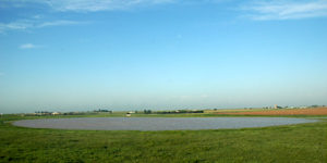
Healthy Playas Recharge Ogallala Aquifer Photo by Ogallala Commons

Healthy Playas Recharge Ogallala Aquifer

Playas, though they may go unappreciated for the life-giving role they play, are critically important recharge wetlands in the Texas High Plains. In the midst of a landscape filled with towns, industries and agricultural activities that mine multiple feet from the aquifer annually, playas give water back to the Ogallala aquifer. Despite their priceless capacity to give back in support of water for the region, playas are losing their function and fading away at an alarming rate.

Those messages were pressed home by Don Kahl, Region 1 Migratory Gamebird Specialist with the Texas Parks and Wildlife Department, who is working diligently with the Texas Playa Conservation Initiative (TxPCI) to restore altered playas to fulfilling their role in the water cycle, and Dr. Chris Grotegut, an area farmer who includes playas in his “live within your means” irrigation management. Kahl and Dr. Grotegut made comments and conducted a field trip at a recent playa landowner field day that included a classroom session at the Hereford Community Center and a visit to a local playa near Dawn.

Some 23,000 of roughly 80,000 playas in the Great Plains states are located in the Southern High Plains of Texas, primarily in the Panhandle and South Plains. Within the Panhandle region, these ephemeral basins could appropriately be called recharge wetlands as they are strongly tied to the Ogallala aquifer.

“We’re trying to get away from calling playas ‘lakes’ as functioning playas have both dry and wet periods. Playas help recharge the Ogallala aquifer and their dry periods are important to recharge due to the large cracks that form in their clay floors when they dry out. The initial rush of recharge is through these cracks when rainwater flows in during thunderstorms, and as the clay swells and seals the recharge occurs on the perimeter of the playa where the hydric soil meets the upland soil in the annular ring of the playa,” says Kahl, who is based in Lubbock.

“Healthy playas ensure recharge of clean water into the Ogallala aquifer. The recharge rate through playas is 10 to 100 times greater than elsewhere. Water that is filtered through playas most benefits wells pumping from the Ogallala aquifer. Three inches of recharge through a four acre playa produces 326,000 gallons of returned water. That’s enough to support two years of residential use for a family of four,” emphasized Kahl.

“Water recharged through playas stays localized where the playa lies. Recharge can range from an inch or less up to 20 inches. The average playa is 17 acres, so that’s considerable water recharged from an average-sized playa—far more if the recharge rate is on the high end of up to 20 inches,” Kahl projected.

The health of the Ogallala is a major concern on the Texas High Plains, where massive historic declines in the freshwater aquifer have occurred due to heavy irrigation and residential use. Land use patterns in agriculture and urban sprawl have both had substantial impact on the function of playas.

Kahl says Texas has a total of 23,037 playas. Of that number, 4,080 are currently categorized as pristine—functional thanks to a good grass buffer around them, no trenching, and no accumulated silt in the basin. Another 5,631 are currently listed as functional but at risk, and a troubling tally of 13,326 playas are categorized as not functional.

Kahl is working with the Texas Playa Conservation Initiative, launched in 2015, to rehabilitate playas listed as not functional. Others partnering with Texas Parks and Wildlife Department in the effort include Playa Lakes Joint Venture, Natural Resources Conservation Service, Ducks Unlimited, Texan by Nature, U.S. Fish and Wildlife Service, and Ogallala Commons.

“Our focus is on backfilling tailwater pits in grass-buffered playas. A hole in the clay pan of a playa, such as a tailwater pit, is a hole in the playa’s filter mechanism. Water gathered in a pit is not productive like rainwater spread shallowly over a whole playa basin. With pits, you lose the shallow water habitat,” Kahl told the workshop audience.

Kahl says TxPCI seeks playas it would like to restore and works with the landowner. The initiative pays 100 percent of restoration costs and hires and directly pays contractors involved in pushing berms alongside tailwater pits back into the pit.

“Playa landowners receive a one-time incentive payment of $80 per playa acre, and must enter into a ten-year agreement that precludes future pit creation in the playa. We contact landowners directly and make site visits prior to entering into contracts. TxPCI pays the landowner and the contractor. Playas that get pit backfilling are remotely monitored,” said Kahl.

The initiative has projects in Castro, Floyd, Swisher Briscoe, Hale and Armstrong counties thus far.

“We have completed 13 pit filling projects with 489 playa acres restored. Thus far, TxPCI has spent an average of $12,305 per project. That’s pretty cheap for wetland restoration,” Kahl said.

He says the initiative hopes to have 25 projects underway in the next couple of months.

Primary funding for TxPCI is via migratory gamebird funds through the Texas Parks and Wildlife Department, federal and North American Waterfowl Conservation Act grants, and regional grants from the U.S. Fish and Wildlife Service.

“We’re beginning to need more staffing now as this project builds momentum. This effort shows that water conservation goes beyond what you do in your household. It’s important to realize where your water comes from, and the important role that playas play in keeping Ogallala aquifer water available,” said Kahl.

By Jim Steiert, an award winning member of the Texas Outdoor Writers Association and a Certified Texas Master Naturalist. Photo of playa courtesy of Darryl Birkenfeld.